For walkers around Braiseworth
Walks & footpaths
Braiseworth is a quiet, largely traffic-free parish of single-track lanes, field-edge paths, a small wood and the River Dove along its southern edge. Its public footpaths are those recorded on the county’s definitive map, and largely connect the historic farmsteads — Gardiner’s Hall, Allen’s Farm and Priory Farm.
On foot around the parish
There is no through-traffic to speak of, so the lanes themselves make good, safe walking. Braiseworth Road and the tree-lined lanes north towards Eye join the wider network of paths around Thornham and Occold. To the west lies Steggall’s Wood, with a path through it; to the south, the River Dove forms the parish boundary and is crossed by a footbridge.
A walking map
The map opens on the standard Ordnance Survey–style OpenStreetMap, which shows public footpaths as dashed lines. Use the control at the top right to switch to a terrain map or to turn on the waymarked-trails layer. Zoom and pan freely.
Maps © OpenStreetMap contributors; terrain © OpenTopoMap (CC-BY-SA); waymarked trails © Waymarked Trails. Always carry an OS map; on-screen paths are a guide, not a legal record of rights of way.
The recorded public rights of way
The definitive map and statement held by Suffolk County Council is the conclusive legal record of every public right of way in the parish — its existence, status and alignment. The working copy is published online and divided by parish.
Braiseworth’s recorded paths are field-edge footpaths and old farm tracks linking the historic farmsteads, together with the path by Steggall’s Wood to the west and the crossing of the River Dove to the south. For the exact number, alignment and status of each path, consult the official record:
View the Suffolk definitive rights-of-way map →
The working copy for this parish is also published directly as a scanned map: Braiseworth definitive map (PDF).
The recorded footpaths
The public footpaths recorded for Braiseworth are listed below. This list is a plain guide drawn from the definitive map; the definitive map and statement held by Suffolk County Council remains the legal record. All the recorded routes within the parish are public footpaths; no bridleways were identified. Approximate lengths are estimated from the 1:10,000 plan and are not precise.
| Path | Type | Approx. length | Alignment and features |
|---|---|---|---|
| Footpath 1 | Footpath | ~0.4 km | South from the northern lane and track, past Braiseworth Wood and Steggall’s Wood. |
| Footpath 2 | Footpath | ~0.5 km | From Braiseworth Lane by the war memorial, east along a field track, then south-east past a pond to Priory Farm. |
| Footpath 3 | Footpath | ~0.4 km | From the Priory Farm area south-east, past the ruined old church of St Mary, to the River Dove. |
| Footpath 7 | Footpath | ~0.3 km | A short path at Priory Farm, linking the farm buildings to Footpaths 2 and 3. |
| Footpath 8 | Footpath | ~1.5 km | A long field-edge path running east across the north of the parish, by Steggall’s Wood, towards the Eye boundary. |
| Footpath 9 | Footpath | ~0.3 km | South from Braiseworth Lane, near Allan’s Farm. |
| Footpath 10 | Footpath | ~0.4 km | West from Priory Farm along a track, towards Gardiner’s Hall and Eastwick. |
Some other numbered paths appear on the map along the eastern and northern edges (for example paths numbered 4 and 11); these follow the parish boundary and may be recorded in the adjoining parishes of Eye or Thornham, so they are not listed above. If you can confirm any path number, length or a route we have missed, please tell us through the Contact page.
Source: Footpaths from Suffolk County Council’s working copy of the recorded public rights of way (definitive map) for the former Rural District of Hartismere, sheet “Braiseworth 153”; relevant date 7 September 2022, issued 31 January 2023. Alignments read from that map; approximate lengths estimated from the 1:10,000 plan.
Two short walks to build from
Both use only recorded rights of way and public lanes. On the ground, follow the waymarks and the definitive map, as some field paths can be indistinct across crops.
- Steggall’s Wood and the lanes (about 2–3 miles) — a gentle circuit on quiet lanes and the field-edge footpath by Steggall’s Wood, west of the village.
- Down to the River Dove (about 1.5–2 miles there and back) — south on field paths to the footbridge over the River Dove on the parish’s southern boundary, returning the same way.
The paths in pictures
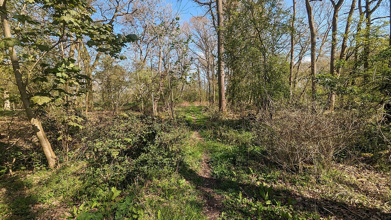

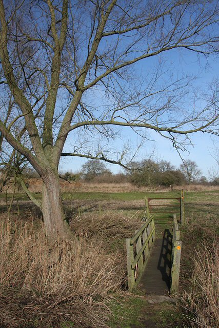
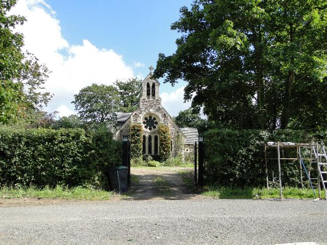
Practical walking guidance
- Using the maps: the map above shows footpaths as dashed lines and is a helpful guide, but the Suffolk definitive map is the legal record; carry an Ordnance Survey Explorer map for certainty on the ground.
- Surfaces and season: most paths are unsurfaced field edges. Expect mud after rain and in winter, and narrowed paths where crops have grown across them in summer. Stout footwear is advisable.
- Livestock and dogs: keep dogs under close control, and on a lead near livestock; close gates behind you.
- Report a problem: an obstruction, a broken or missing waymark, or an overgrown path can be reported to Suffolk County Council through the report a rights-of-way issue page or the highways reporting tool. Do not report a highways emergency online — telephone 0345 606 6171.
Further afield: Thornham Walks
About two to three miles south-west, at Thornham Magna, the Thornham Estate keeps Thornham Walks — the nearest place for a longer, fully-signposted walk, reachable from Braiseworth by quiet lanes.
- About 12 miles of waymarked trails through parkland, woodland, farmland and water meadows, with a walled garden, glasshouses, fishing lakes, a pinetum and a butterfly ride.
- A short, accessible tarmac path (about half a kilometre) leads to the walled garden; longer routes cross the fields.
- Facilities: café, children’s playground, picnic area, eco toilets, and a pay-and-display car park (Monday to Saturday £2; Sunday and Bank Holidays £3).
- Open 9am–6pm April to October, and 9am–4pm November to March. Information: thornhamestate.com, 01379 831242.
See also our Landscape & nature page for the wildlife of these paths, Surrounding villages for the places named here, Visiting for finding Braiseworth, and Local & community for other local information.
Source: Public rights of way as recorded on Suffolk County Council’s definitive map and statement (the legal record; working copy published by parish). Thornham Walks details from the Thornham Estate. Photographs via Geograph / Wikimedia Commons, reused under CC BY-SA 2.0 with credit. Checked 26 August 2026
Last verified 26 August 2026